The Hook: A Map Where Everything Shrinks
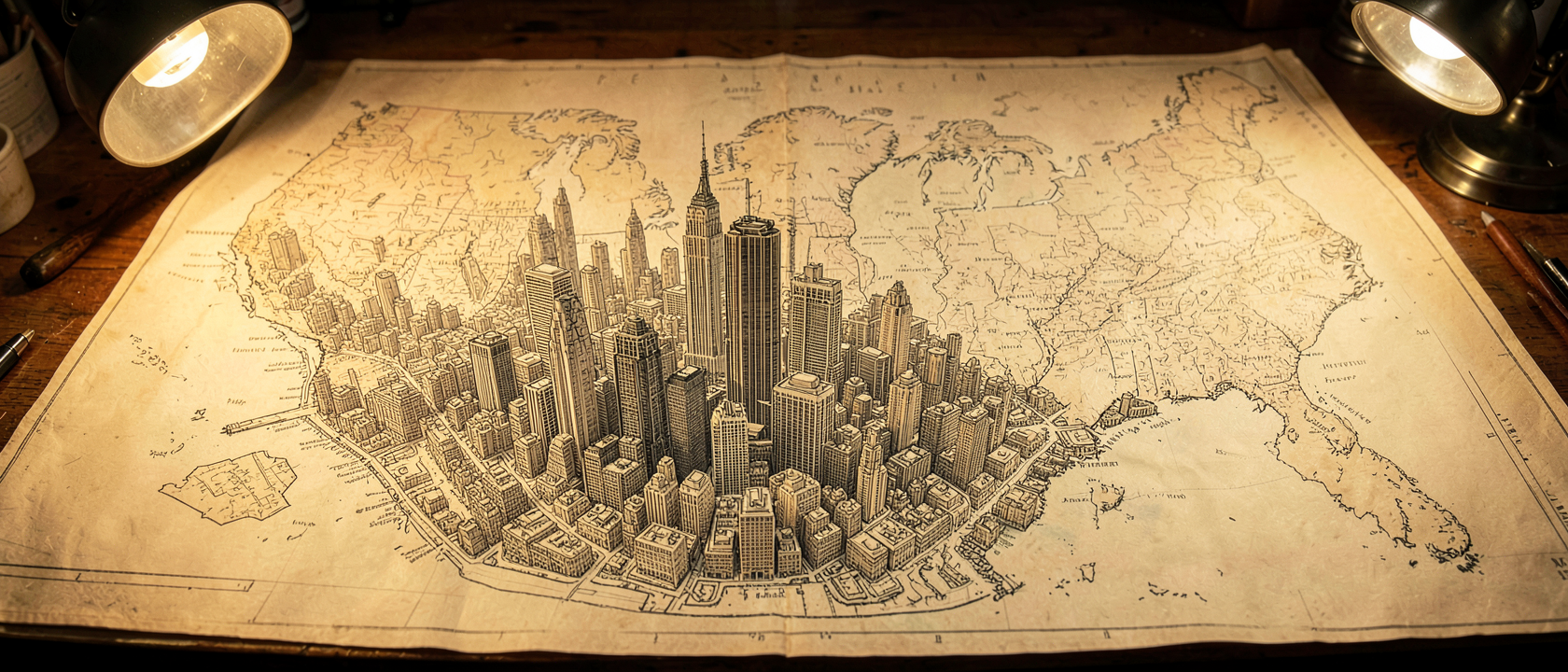
Picture a map of the United States where New York City swells to take up nearly the whole page, while the other states get squeezed into vague, half-finished shapes along the edges, Ohio reduced to a gray smudge, California pushed off to one corner like an afterthought. That’s the joke behind “The Map of America As Seen by a New Yorker,” a satirical illustration by artist Dan Abramson, posted to Funny or Die on July 12, 2011, and picked up by the blog Neatorama on July 13, 2011.
Abramson, a New Yorker poking fun at his own city’s blind spot, captioned the piece: “New Yorkers have no sense of geography, which is fair, considering the world revolves around their city.” He also wrote that “as far as I know, it’s 100% accurate.” It isn’t a real map, it’s a map of ego, drawn to the scale of how large New York feels to the people living inside it.
The Mystery: Why Draw America This Way?
The real question is why this joke keeps working, decade after decade. The stereotype is precise: New Yorkers, the gag goes, treat their city as the fixed point the rest of the country quietly orbits, with everywhere else reduced to background noise or a place someone is merely “from.”
This isn’t a one-time bit, it belongs to a long line of illustrated maps built around regional main-character syndrome. Which raises a better question than “is this accurate?”: why does distorting a map feel like such an honest way to describe how a mind actually works?
The Reveal: Mapping a Habit of Mind
Because Abramson’s drawing is a cartoon version of something real. People tend to think in a lopsided way: the closer something is to daily life, the bigger and more detailed it looks; the farther away, the smaller and blurrier it gets. Call it a mental shortcut rather than a scientific law, but it’s one most people recognize the second it’s pointed out. A few blocks from your front door can feel enormous in detail; a state you’ve never set foot in can feel like a rumor.
The joke lands because it isn’t entirely wrong, everyone’s mental map is lopsided this way, just not usually this dramatic. Abramson takes a habit every brain has, enlarging the familiar and flattening the distant, and pushes it to a cartoonish extreme, with New York standing in as the most famous example of a city built around itself.
The bit is also older than it looks. A similar satirical map ran in the Chicago Tribune in 1922, Columbia University Press distributed another version in 1936, and the joke resurfaced again in 1970. In 1939, cartographer Daniel K. Wallingford drew “A New Yorker’s Idea of the United States of America,” a 12 x 16 in (30.48 x 40.64 cm) piece tied to that year’s New York World’s Fair, with an oversized Florida fed by four rivers all labeled “Swanee River,” while Hollywood and San Francisco balloon up to claim two-thirds of California. The 1936 version notably anticipated Saul Steinberg’s famous New Yorker cover “View of the World from Ninth Avenue” by 40 years. Abramson’s map is simply the latest draft of a joke cartographers have been sketching for about a century.
Myth-Busting: The Stereotype Behind the Joke
All of this rides on a second stereotype: that New Yorkers are rude. The Neatorama author who shared Abramson’s map pushed back, writing that the city’s reputation for being “rude and brusque is wholly undeserved,” adding that New Yorkers are, in fact, direct.
That distinction carries weight. A stranger firing off quick, blunt directions isn’t being hostile, it’s the local version of helpfulness in a place where everyone moves fast and nobody has time to pad a sentence. Mistake efficiency for coldness and you’ve misread the whole city. The same author called the map “entirely accurate,” based on personal encounters, which says less about geography than about how well the joke matches people’s lived experience of the place.
The Real Punchline: Where Does Anyone Interesting Live?
The sharper joke sits one layer underneath the map. It isn’t that New Yorkers think their city is big, it’s that plenty of them seem to assume anyone worth admiring must live there too, as though talent and New York were the same postal code. Mention someone impressive, and the first guess is “oh, they must be in the city,” even when nothing points that way. The reaction outlived the joke itself: Gothamist posted a blank outline of the country and invited readers to fill in how New Yorkers imagine the rest of it, proof the bit had struck a nerve.
Here’s the part worth sitting with: this habit isn’t a New York thing. Everyone carries their own lopsided version of this map, drawn in sharp detail up close and shrunk into background scenery everywhere else. Noticing it in a joke about one city is really just noticing it in yourself.