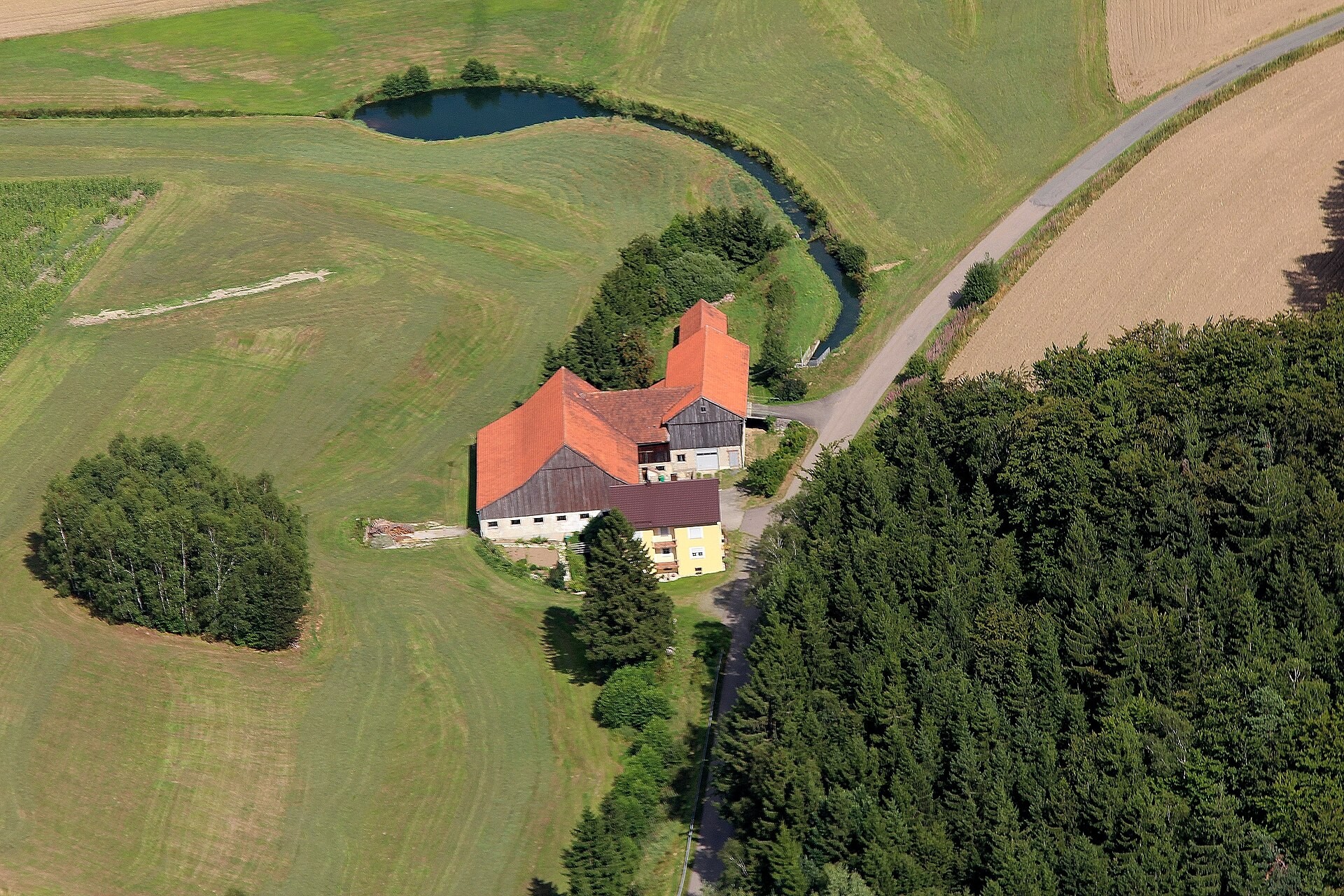
Höcherlmühle is a small solitary settlement — classified in German administrative terminology as an Einöde — belonging to the municipality of Teunz in the Schwandorf district of Bavaria, Germany. It sits at 620 metres above sea level in the north-eastern part of the district, within the Oberpfalz-Nord planning region. The hamlet is modest in size and would attract little outside attention were it not for one feature beneath the ground: the Erdstall Höcherlmühle, a medieval underground tunnel whose radiocarbon-dated construction stretches somewhere between the mid-tenth and mid-twelfth century, placing it among the oldest reliably dated Erdstall tunnels known in Europe.
Key facts
- Country: Germany
- Type: Ortsteil
- Located in: Teunz
- Coordinates: 49.5220, 12.4186
- Elevation: 620 m
Location and setting
Höcherlmühle lies at coordinates 49.5220° N, 12.4186° E, within the municipality of Teunz, whose full territorial area covers 30.7 km². The municipality sits directly on the Bundesstraße B 22, the federal road running between Weiden and Cham. The landscape around Höcherlmühle falls within both the holiday region known as “Oberviechtacher Land” and the Naturpark Oberpfälzer Wald, a protected natural park of approximately 82,000 hectares. In 2026 that park was certified for the first time as a “Qualitäts-Naturpark” under the criteria of the Verband Deutscher Naturparke.
The highest point in the municipal territory is the Wildenstein rock massif near the hamlet of Wildstein, which reaches 744 metres above NHN. Höcherlmühle itself is listed among the Weiler and Einöden of Teunz alongside Ödreichersried, Kühriedermühle, Tannenschleife, Hermannsriedermühle, Hermannsried, Hebermühle, Miesmühle, and Tannenmühle.
Watercourses
The Höcherlbach, a stream whose source lies near the hamlet of Wildstein, runs through Höcherlmühle. Together with the Hundsgraben and the Tannenbach, which comes from the direction of Wildstein, the Höcherlbach merges to form the Trausnitz — recorded on some maps under the alternative name Faustnitz. That combined stream then flows into the Murach river at a point below Teunz.
The Erdstall Höcherlmühle
Beneath or immediately adjacent to the hamlet is an Erdstall: one of the small, low-ceilinged underground tunnels found in significant numbers across Bavaria and Austria, with scattered examples in France, Ireland, and Scotland. Radiocarbon (C-14) analysis was carried out on charcoal recovered from the construction shaft of the Höcherlmühle Erdstall. The results placed its construction in two possible ranges: 991 to 1163, or alternatively 954 to 1071. Both intervals fall within the early to high medieval period, making this one of the more securely dated examples of the Erdstall type.
A detailed archaeological study of the finds from this site was published in 2004 by Thomas Beilner, Harald Schaller, and Peter Forster in the journal Beiträge zur Archäologie der Oberpfalz (volume 6, pages 303–318, ISSN 1433-433X). That publication remains a primary reference point for researchers examining the construction chronology and artefact record of Erdstall tunnels.
Municipal context
Höcherlmühle became part of Teunz through the amalgamation of the formerly independent municipality of Wildstein into Teunz during the Bavarian territorial reform completed in 1978. On 21 July 2011, the Teunz municipal council resolved to declare the municipality’s own lands free of GMO cultivation. The accompanying “Gentechnikanbaufreie Kommune” logo was formally presented to Mayor Norbert Eckl by State Minister Dr. Marcel Huber on 9 February 2012.
Did you know
- Although Höcherlmühle is classified as an Einöde, a category denoting a solitary, isolated settlement, it gave its name to an archaeological site with reach well beyond Bavaria. The Erdstall Höcherlmühle is cited in international research on medieval underground tunnel systems documented across Germany, Austria, France, Ireland, and Scotland. (interestingengineering.com)
- The name of the parent municipality, Teunz, is believed to derive from the Slavic word “tync,” meaning “small fortress,” or “tyn,” meaning “wall or enclosure.” The etymology points to a period of Slavic settlement in the region that predates the later German-speaking population. (vg-oberviechtach.de)
- The coat of arms of Teunz displays four merlons (Zinnen), each representing one of the four formerly independent municipalities — Fuchsberg, Teunz, Wildstein, and Zeinried — that were merged into Teunz during the Bavarian territorial reform completed in 1978. Höcherlmühle entered the municipality as part of the Wildstein merger. (dewiki.de)
- The hamlet of Wildstein, which is the source of the Höcherlbach flowing through Höcherlmühle, lies along the Fränkischer Jakobsweg (Franconian Way of St. James) and serves as a waypoint for pilgrims travelling that route. (quaeldich.de)
Data sources
- Wikidata
- oberpfalzwiki.de
- historisches-lexikon-bayerns.de
- dewiki.de
- vg-oberviechtach.de
- oberpfaelzerwald.de
Data updated: 2026-10-31