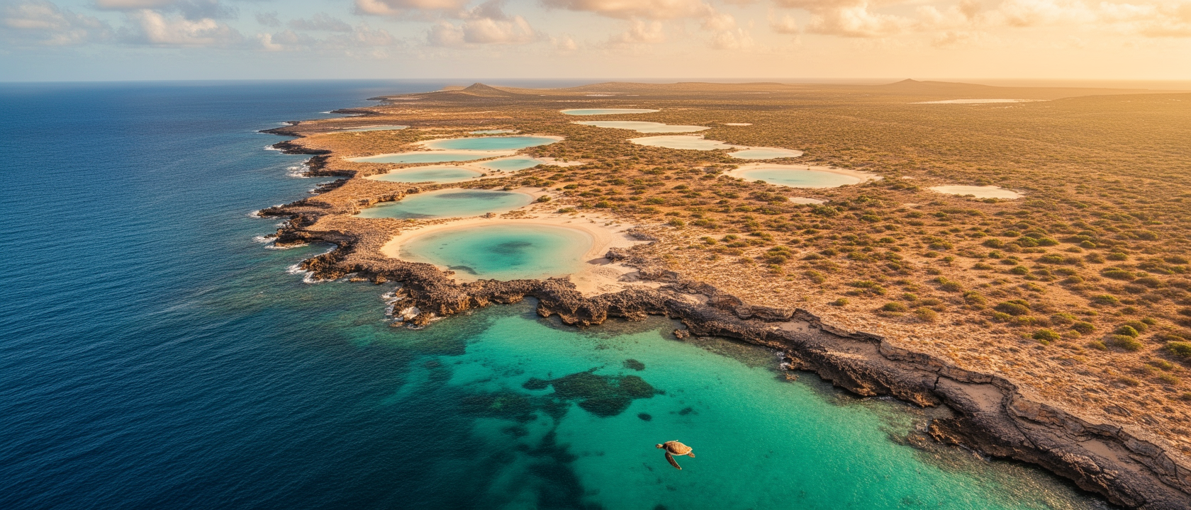
A Secret Slice of Wilderness
Most people who picture Curaçao see the pastel-painted Dutch colonial facades of Willemstad, or the coral-rich dive sites along the south coast. So it is genuinely disorienting to find that roughly one-tenth of the island is a blank on the map: no roads, no resorts, just a stretch of ragged coastline in the southeast where the land seems to run out of names.
That blank is Oostpunt, also known locally as “Land van Maal.” It covers about 21 square miles (54.24 km²) of rocky bluffs, hidden lagoons, and low scrub that has never been cleared for a hotel or parking lot. From satellite imagery, the contrast with the rest of Curaçao is stark: one part is patterned with roads and rooftops; Oostpunt looks almost prehistoric.
The Invisible Border
Curaçao’s beaches and natural landmarks are largely open territory: locals fish, tourists snorkel, the coastline feels shared. Oostpunt is different. There are no public trails, no signage, no infrastructure suggesting you are supposed to go in. Caribbean coastline with turquoise lagoons and undisturbed reef is exactly what developers pursue, which makes prime real estate sitting completely untouched raise an obvious question: why has nobody built anything?
The Power of a Single “No”
Somebody already owns it and has not been selling. Oostpunt is not a government reserve or military exclusion zone. It is private land, held by the Maal family since the 1870s. Dutch army officers by origin, the Maals arrived in Curaçao in the late 18th century and had consolidated five plantations across the southeastern corner by the 1870s. Eventually the crops and cattle gave way to the land itself, and Oostpunt became one of the most intact pieces of Caribbean wilderness still in private hands.
The family’s stated reasons for restricting access are practical: keeping out illegal dumping and drug activity, and protecting what the land has naturally become. For most of its history, the answer to any development proposal was simply no. In May 2023, some of that changed when the Maal family sold approximately 1,089 hectares (about 2,691 acres), roughly one quarter of the total area. Before that sale, the land was entirely undivided family property.
Accidental Conservation
No roads means no runoff carrying oil and debris into the lagoons. No foot traffic means no compacted soil and no disturbed nesting ground. No hotels means no artificial light confusing sea turtles during nesting season, which on Curaçao runs from April through September. Three endangered species nest in these waters: the green turtle, the hawksbill, and the loggerhead. The 2011 census recorded just 555 inhabitants across the region’s three villages, sparse even by rural Caribbean standards, and the effect shows up in what you do not find: eroded cliffs, bleached reef, wildlife that has learned to flee at the sound of footsteps.
The View from Above
Travel writers Mike Powell and Jürgen Horn documented 91 days of life on Curaçao. Their account of a helicopter flight over the southeast captures what the restriction means in practice. Hovering just a few metres above a lagoon’s surface, they watched a sea turtle moving through the water beneath the aircraft, showing no sign of alarm. A turtle in a lagoon that has never had a person wade into it has no learned reason to flee, and the water clarity that makes the animal visible depends on the same undisturbed conditions that allow it to be there at all.
A helicopter is the one way to witness Oostpunt without setting foot on the land. The view works precisely because the ground below has been locked away for over 150 years. The family that refused developers had, without intending to, preserved something far more valuable.